

Los Hervideros is a strip of coastline that formed during the Timanfaya eruptions that took place between 1730 and 1736. The enormous quantity of lava extended down to the coast, increasing the size of the island in the southwest. In fact, the six years of eruptions added some twenty-five kilometres of rugged and impassable coastline from Janubio to Tenésar. The stretch between El Golfo and Janubio is possibly the most jagged and spectacular, with cliffs towering over 40 metres high, caves, arches plus a section of rocks where the sea has pierced a hole in the rocks and the waves enter with such a force that they crash and foam, making it look likes it’s boiling, hence the name Los Hervideros, or boiling pots. A series of narrow ledges and viewpoints allow visitors to lean out and feel the reverberations of the sea as it thunders in and out.
A road winds its way fearlessly through the lava fields, surrounded by jagged cliffs and the wild sea. It is always rough in this section of the coast and pounds the rocks with enormous force. You can’t help but imagine what it must have been like during the eruptions, when the earth was spitting fire and rivers of burning lava advanced towards the sea, creating violent explosions and columns of smoke that could be seen and heard from as far away as Gran Canaria, according to testimonies of the time.
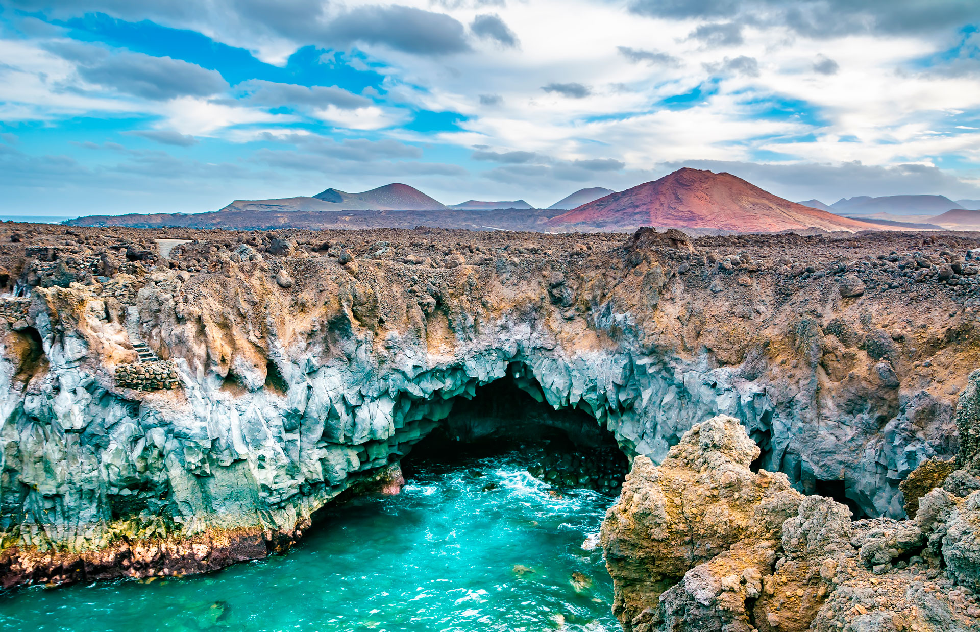
During the eruptive process, rivers of thick lava crept slowly towards the coast. When the basaltic material on its surface started to cool, it would fragment, but inside it remained incandescent. When, at last, it came into contact with the sea, this heat caused the water to boil and eventually, the lava became totally petrified. Los Hervideros is one of the island’s many spectacular tourist attractions and is listed as Geosite nº 37 in Lanzarote’s Geopark.
